GTA 5's Best Viewpoints: The Dam, the Observatory and Every Iconic Vista
The Land Act Dam, the Galileo Observatory, Mount Chiliad and the Vinewood Sign: where to find GTA 5's best views, and how to reach every one fast.
The best view in GTA 5 is arguable, but four spots settle most debates: the Land Act Dam, the Galileo Observatory, the summit of Mount Chiliad and the Vinewood Sign. Between them you get the whole state of San Andreas laid out below you - reservoir, skyline, mountains and coastline - without a loading screen in sight.
The essentials:
- Land Act Dam - a curved concrete dam over the Land Act Reservoir, in the Tataviam Mountains east of Los Santos.
- Galileo Observatory - the single best panorama of the city, in Galileo Park, Vinewood Hills.
- Mount Chiliad - the tallest peak in San Andreas, with a wooden observation deck and coin-op telescopes.
- Vinewood Sign - the postcard shot of Los Santos at sunset, on Mount Haan.
- Secondary spots worth the detour: Kortz Center, Raton Canyon Overlook and Mount Josiah.
Land Act Dam: Los Santos's Concrete Giant
The Land Act Dam holds back the Land Act Reservoir, the fictional city's main water source, tucked into the Tataviam Mountains east of Los Santos. It's an arch dam modeled on real Southern California structures like the Morris Dam and the Pacoima Dam rather than the Hoover Dam, which is why it feels compact and dramatic instead of monumental.
What makes it worth the drive is the drop. Stand on the walkway and the reservoir stretches out on one side while a sheer concrete face falls away on the other - one of the best free-fall or wingsuit launch points in the base game, long before GTA Online added dedicated parachute jumps nearby. It's also one of the quieter parts of the map, so it's a reliable spot to line up a screenshot without traffic or pedestrians wandering into frame.
Getting there: head northeast out of Los Santos on the Senora Freeway, cut into the mountains past Tongva Hills, and the access road drops you right at the dam wall.
Galileo Observatory: The Best Skyline Panorama
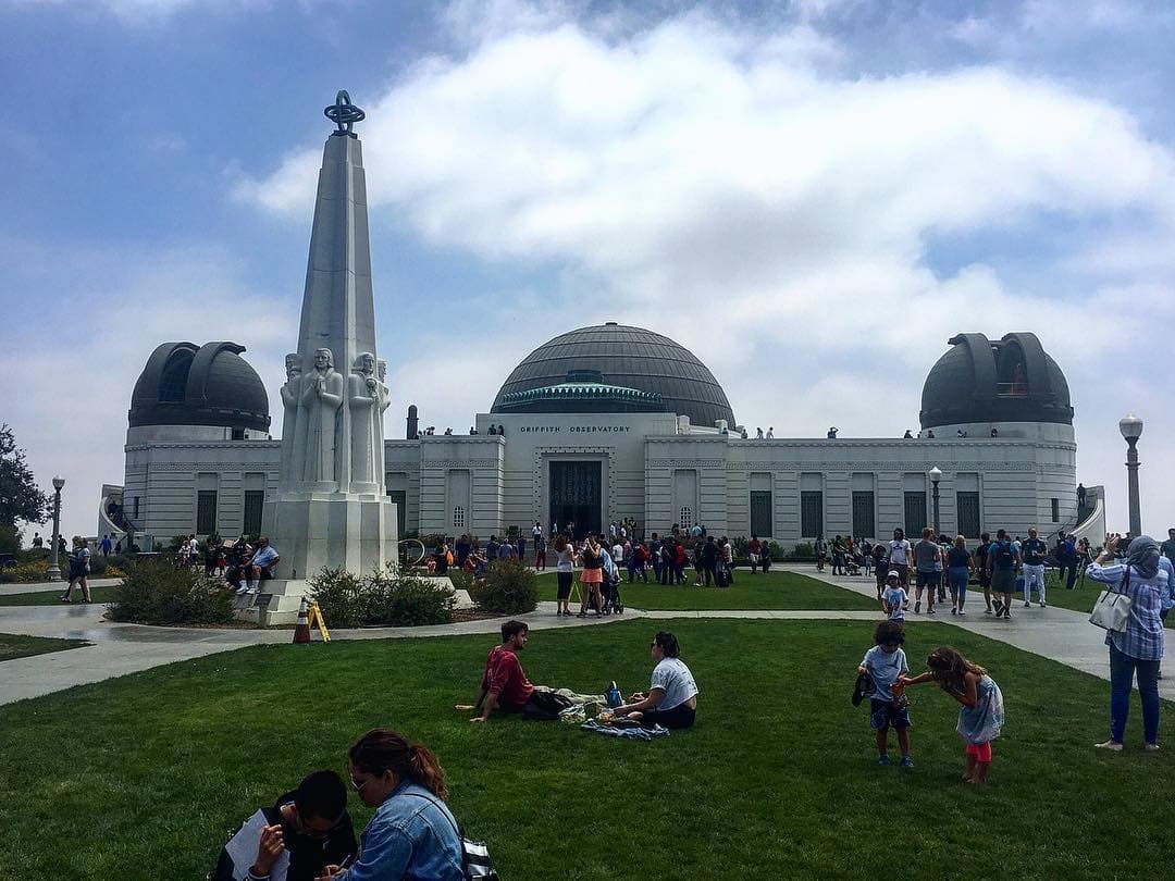
If you only visit one viewpoint, make it this one. The Galileo Observatory sits in Galileo Park in Vinewood Hills, on one of the highest points overlooking the city, and it's a clear parody of Griffith Observatory in Los Angeles - domes, terraces and all. From the front steps you get a sweeping, uninterrupted view of downtown Los Santos, the Maze Bank Tower, the ocean beyond Del Perro and, on a clear day, all the way to the airport.
The observatory is also functional in-game: there are telescopes on the terrace, and it's a common stop for players hunting the map's Easter eggs, including the long-running rumors tied to the Mount Chiliad mystery. If you want the full background on that particular rabbit hole, we cover it in our guide to the GTA 5 Mount Chiliad mystery.
The best time to visit is at in-game sunset. The lighting hits the domes and the downtown skyline at the same time, which is why this is the single most screenshotted location in the game.
Mount Chiliad: The Highest Point in San Andreas
Mount Chiliad is the tallest mountain in the state, and reaching the summit is a rite of passage for most players. At the top sits a small wooden observation deck with two coin-operated telescopes, a dollar each, that let you scan the coastline, the desert and the cable car line running up the mountain's east face.
The view from the deck covers almost the entire map on a clear day: Paleto Bay and the northern coast to one side, the Alamo Sea and Grand Senora Desert to the other, and the whole sprawl of Los Santos in the distance if you look south. It's also the anchor point for the mountain's cult mural and glyphs, which fed years of community theories about a hidden ending. We go through the full timeline and the theories in our GTA 5 Mount Chiliad mystery explainer, and whether the mystery could resurface is something we cover separately as well.
Getting up: the cable car is the lazy option, a dirt bike up the fire road is the fast one, and jumping off the summit with a parachute is the reward for either.
Vinewood Sign: The Postcard Shot
Sitting on the ridge of Mount Haan, the Vinewood Sign is San Andreas's answer to the Hollywood Sign, and it delivers the same kind of view: the entire basin of Los Santos spread out below, framed by the giant white letters in the foreground. It's less about elevation and more about composition - this is the spot that looks best in a screenshot, especially with the sunset behind the tower blocks.
It's a short climb from the surrounding streets in Vinewood Hills, and unlike the observatory or the dam, there's no real activity here beyond the view itself - it exists purely as a landmark, which is exactly why it works as one.
Kortz Center: A Quieter, Cinematic View
Less visited than the observatory but arguably just as photogenic, the Kortz Center in Pacific Bluffs is a cultural complex loosely based on LA's Getty Center - white stone buildings, manicured gardens and terraces that look out over the western edge of Los Santos and the ocean. It's a good stop if you've already done the observatory and want a different angle on the same city, closer to sea level and with none of the crowds.
Raton Canyon Overlook and Mount Josiah
Out in Blaine County, Raton Canyon is a national park that splits Mount Josiah from the Chiliad Mountain Wilderness, and at its eastern end sits an observation platform overlooking the Alamo Sea, complete with an in-game sign identifying what you're looking at. Mount Josiah itself, the second-tallest peak in the state, sits west across the canyon and offers a rawer, less curated view - no deck, no telescope, just rock and altitude.
Both are far enough from the city that they rarely make anyone's first-timer list, which is exactly why they're worth adding if you've already covered the well-known spots. For more locations like these that don't show up on the main map markers, our list of secret GTA 5 locations covers the rest of the map's overlooked corners.
How to Reach Every Viewpoint Fast
- Fastest overall: a fast car or dirt bike on the Senora Freeway and Route 68 connects the dam, Chiliad and Raton Canyon without much backtracking.
- Best for the observatory and the sign: any vehicle from Vinewood, they're a few minutes apart inside Vinewood Hills.
- Best for photos: switch to first-person, wait for the in-game clock to hit sunset (roughly 19:00-20:00) and turn off the HUD in settings for a clean shot.
- Fastest way down: a parachute at the dam, the observatory ledge or the Chiliad summit turns every one of these into a launch point, not just a lookout.
Are Any of These Viewpoints Tied to Missions?
Not directly for most of them - the dam, the sign and the two canyon spots are free-roam locations with no story missions attached. The observatory and Mount Chiliad do intersect with side content and the map's long-running mystery threads, which is part of why they draw repeat visits years after launch. If you're chasing 100% completion and want to know which locations actually gate progress versus which ones are just worth seeing, our GTA 5 100% completion checklist breaks down what counts and what doesn't.
Will Anything Like This Exist in GTA 6?
Rockstar has a track record of building at least one signature high-altitude landmark per game, and the trailers for GTA 6 already hint at Vice City's own skyline and coastline doing similar work. We don't know yet if there's a direct equivalent to the observatory or the dam, but it's a safe bet that Leonida will have its own version of the "climb it for the view" spot once the map is fully explorable.
Comments (0)
No comments yet. Be the first!